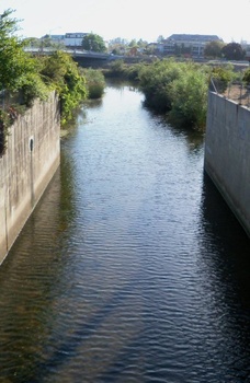
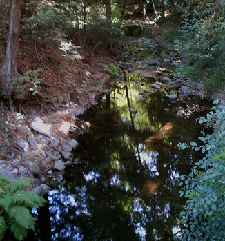
Branciforte Creek' is a 9 miles long creek with numerous tributaries feeding into it. The creek's headwater is in the Santa Cruz Mountains, about a half mile east of Highway 17, just south of Jarvis Road. It winds through the Happy Valley area and then flows through areas along Branciforte Drive. When the creek enters the Santa Cruz city limits, the last mile of the creek flows in a concrete flood control channel built by Army Corps of Engineers. This one-mile section also has a paved trail that runs next to the creek for pedestrian and bicycle use. The creek flows through town and dumps into the San Lorenzo River in between San Lorenzo Park.and Soquel Avenue.
History
 Where Branciforte Creek flows into the San Lorenzo River. The historic Glen Canyon Covered Bridge (built in 1897) use to cross over Branciforte Creek at Glen Canyon Road. In 1939, it was moved upstream to DeLaveaga Park where it was refurbished for pedestrian use. The bridge was eventually torn down because the structure has severely deteriorated and was deemed unsafe. The area of Market Street Field near Branciforte Creek was an Ohlone site. In August of 2011, 6000 year old shell fragments were found in the knoll above the field as KB Home began to develope the area. The undated bones of an adolescent were also uncovered and excavated by archaeologists, sparking controversy over the preservation of the location as a sacred site.
 Branciforte Creek within the city limits of Santa Cruz
Landmarks
Tributaries
 |
This entry is a seed - a starting point for writing a full entry. You can help the Santa Cruz Wiki by expanding it! Simply click on the "Edit" button. |


