 |
This entry is a seed - a starting point for writing a full entry. You can help the Santa Cruz Wiki by expanding it! Simply click on the "Edit" button. |
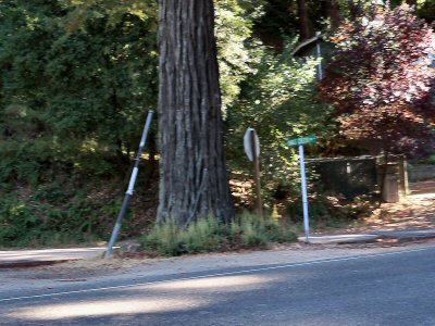
 Where Kings Creek Road meets Highway 9. Kings Creek Road connects off Highway 9 north of Boulder Creek. It has minimal traffic and continues for ~4.5 miles and ends at the Vajrapani Institute. Beyond the Vajrapani institute, the road becomes a service road that is only open for hiking. The trail climbs ~2.7 miles until another gate which is posted as Private Property. There is a ~0.1 mile section that is private property (http://goo.gl/hEGVHb), and then the trail goes for ~0.8 miles to Hwy 35. Because of the short section of private property, it is not possible to travel the full length of Kings Creek Road without trespassing.
It was named for James King who had a ranch in the area in the mid to late 1800's.
Bike-Friendliness
There are no bike lanes. The road rises gently as it continues. There is minimal traffic.
Public Transportation
Bus route 35 (Mountain Store) passes by on Highway 9.
Landmarks
Miller Property County Park Vajrapani Institute
Major Intersections
Restaurants and Shopping
On Highway 9. Nearest town is Boulder Creek, south on Highway 9.
Services
none.


