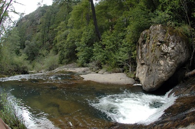
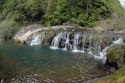
 Woodwardia Falls is a small cascade located in Big Basin Redwoods State Park along the east branch of Waddell Creek. It is not generally listed in trail guides, and has not been featured in an official Big Basin trail map since the early 1960s. This may be due to the fact that the park's sewage treatment plant is located upstream, and besides polluting the water, it is a minor blight on the hike. This is a shame because there are a lot of beautiful sights to be seen along the way, including one of the tallest sheer cliffs in the Santa Cruz Mountains, which is located just downstream from the falls. According to Santa Cruz Place Names: A Geographical Dictionary Woodwardia Falls was named due to the large amount of Woodwardia Ferns present at the site at the time of naming it. Woodwardia Falls is mentioned in California Redwood Park by Arthur A. Taylor, published in 1912, specifically in the passages, "....down the Waddell to Woodwardia Falls...." (pg 65), and, "Woodwardia Glen, a mile or so above Woodwardia Falls on the Pine Mountain Trail, where the luxuriant fronds cover an acre or more and grow as tall as a man." (pg 80)
Directions From Park Headquarters Woodwardia Falls is located along Last Chance Fire Road and can be reached by taking the section of the Redwood Loop Trail that follows Highway 236 to Blooms Creek Campground. Last Chance Fire Road can be found by walking through the campground, and passing through a locked gate on the paved road. The paved road turns into a fire road, then becomes more of a single track trail. Woodwardia Falls is then located approximately 2 miles away, along the north side of the trail/fire road. The hike is approximately 4.5 miles round trip when starting from park headquarters, and is moderately level the whole way.
Related Links
 |
This entry is a seed - a starting point for writing a full entry. You can help the Santa Cruz Wiki by expanding it! Simply click on the "Edit" button. |


