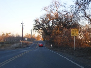
The Dips are a stretch of roadway located just outside the small town of Dayton along Ord Ferry Road. The area is agricultural, with orchards covering the landscape. With the orchards comes the need for irrigation ditches for runoff. Rather than raising the roadway above the ditches, the road takes a series of dips. This is not an issue whatsoever during the dry season, but they flood during heavy or prolonged rainfall. Therefore, as one approaches the dips, one finds cautionary signs warning of the possibility of flooding. There are red lines painted across the road showing a maximum water level at which it is safe to pass. The signs warn that one should not proceed if the water level is above the red line. This warning should be heeded by all, as it nearly never fails that someone will attempt to cross when the water is above the red line and find him or herself stranded.
From Chico, the main reason one would encounter the dips would be taking the back way to Interstate 5 via Willows. When they are flooded, the alternate route to I-5 is through Orland via Highway 32. Butte County Public Works offers road conditions on their website if you are ever concerned whether the dips will be crossable.


