Overview
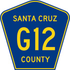
County Route G12 is 11 miles of rural highway that runs North-South from Watsonville, starting out as Main Street at the Highway 129 intersection, crossing over the Pajaro River into Monterey County, where Main Street turns to Porter Drive for 1 block at the San Juan Road (County Route G11) intersection, then into Salinas Road. Route G12 veers onto Elkhorn Road, then continues on as Hall Road, until it merges onto San Miguel Canyon Road and continuing into Prunedale where it ends at the intersection with US 101 highway.
Bike-Friendliness
Relatively safe for bikes. Since this is a rural highway, be aware of fast moving traffic.
Public Transportation
Landmarks
Major Intersections within Santa Cruz County
Businesses and Services
Maps
"County Route G12", "36.906847", "-121.75308"


