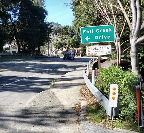
 Bridge over Fall Creek at Highway 9 outside of Felton. Photo: February 2010.
Fall Creek has two branches that become one stream and connect to the San Lorenzo River in Felton. Bennett Creek joins Fall Creek after the two branches of Fall Creek merge and before the junction of the San Lorenzo River.
As names go, anytime you see a "Creek" described as "Fall" you can guess it has a few water falls.
Fall Creek Truck Trail runs along the east ridge above Fall Creek. It is a gated fire access road. It passes through the Fall Creek Unit, and is identified on park maps as the Truck Trail, a 2.5 mile trail open for hiking and equestrian use. Beyond the park its use may be discouraged; according to the rangers at Henry Cowell Redwoods State Park, it is for emergency use only.
Fall Creek Unit is a section of forest. The Cowell Foundation donated over 2,300 acres of forested land to the State of California, That includes the canyon where Fall Creek is located. Although it is located about two miles from Henry Cowell Redwoods State Park, it is administered by that state park. It includes nearly all the area drained by the north and south streams of Fall Creek. It is often called Fall Creek State Park on some maps and websites. It is not listed as a State Park on the map of California State Parks and the Department of Forestry still list it as the Fall Creek Unit of Henry Cowell State Park.
Fall Creek Drive, Fall Creek Road. Fall Creek Drive connects to Highway 9 in Felton near the bridge over Fall Creek. Fall Creek Drive becomes Farmer Street. On some maps, you see Fall Creek Road joining Highway 9 and it becomes Fall Creek Drive before it becomes Farmer Street. This is one of those cases where the street sign says "Drive" and the map says "Road." (Google maps didn't make the correction until 2010.) History Fall Creek was once known as "Humbug Creek." The term humbug was used to mean a mining spot that didn't produce or even a stream that went dry. There is no record of why it was called Humbug Creek.
Foreman Creek was listed on some maps as Fall Creek. This was an error.
Businesses
There are no businesses in the Fall Creek Unit. The forest unit is a quiet area where you cannot hear traffic. Fall Creek is rugged canyon area. There are businesses where Highway 9 crosses over Fall Creek. (It borders the town of Felton.)
Transportation
Only hiking trails enter the Fall Creek Unit forest area. The creek is non-navigational. Santa Cruz Metro Transit Bus Route 35 and 33 cross Fall Creek Bridge on Highway 9.
Maps
USGA maps for Fall Creek.
| sequence | ID | County | Latitude | Longitude | Ele(ft) | Map |
| 1 | Fall Creek | Santa Cruz | 370334N | 1220442W | 246 | Felton |
| 2 | Foreman Creek | Santa Cruz | 370749N | 1220801W | 545 | Big Basin |
 |
This entry is a seed - a starting point for writing a full entry. You can help the Santa Cruz Wiki by expanding it! Simply click on the "Edit" button. |


