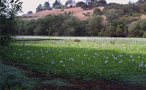
 Yes, there is water underneath all that vegetation...
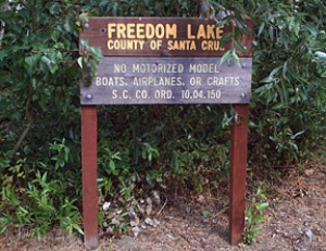
  This is the only evidence anywhere that this is Freedom Lake.
| Location |
| "2901 Freedom Boulevard, Corralitos, CA 95076", "36.96767", "-121.815639" |
| Size |
| 22 acres. |
| Established |
| (Date, i.e. MM-DD-YYYY) |
| Hours |
| Sunrise - Sunset. |
| Website |
| http://www.scparks.com/scott.html |
| Phone |
| (831) xxx-xxxx |
| Features |
| Trails |
| Events |
| (Insert Here). |
This lake is next to Scott County Park. On the official USGS maps, this body of water is listed as Corralitos Lagoon. The USGS does not recognize Freedom Lake in Santa Cruz. Not even as an alternative name. The County Parks Department call it Corralitos Lagoon in the directions to Scott Park on their website (http://www.scparks.com/scott.html). Aside from the sign, there is no official record of a Freedom Lake in Santa Cruz County. Most maps list it as Corralitos Lagoon.
This body of water is also known as Chandler Lake, from when the property was owned by the Chandler family. Because it is across the road from Scott park, the lake has also been called Scott Lake.
Freedom Lake and the adjacent Scott Park land was given to the County of Santa Cruz in 1971 by Bert Scott, former CEO of Granite Construction. During the past couple of years, the lake has been infested by an over growth of a non-native aquatic plant called the Water Hyacinth, which is disrupting the ecosystem of the lake. This invasive plant also harbors the growth of mosquitoes, which is known to spread mosquito-borne diseases. There are plans in the works to eradicate the plant before they spread to other waterways.
Map
As Corralitos Lagoon it is on a USGS map:
| Sequence | Latitude(DEC) | Longitude(DEC) | Latitude(DMS) | Longitude(DMS) | Map Name |
| 1 | 36.9655071 | -121.8138420 | 365756N | 1214850W | Watsonville West |


