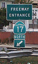
Overview
This article refers to a highway corridor. Highway 17 may also refer to the Highway 17 Express, a bus running between Santa Cruz County and San Jose. The map shows Highway 17 in Santa Cruz County, and not the entire length.
Highway 17 connects Highway 1 and Interstate 880. The highway navigates through the Santa Cruz Mountains and is often used to reach San Jose, which has the nearest train station , international airport and In-N-Out Burger.
Highway 17 frequently undergoes construction, which can slow down traffic. Accidents also occur relatively frequently, as the road is quite windy and people tend to drive way higher than the speed limit.
There are cameras on Highway 17 in Santa Cruz that can be viewed on the internet, operated by Cal Trans.
:At Ocean Street in Santa Cruz
There are several traffic cams listed for Highway 17 and Highway 1 at cruz511.org
Amtrak runs a Highway 17 Express bus from the Santa Cruz Metro Center to the San Jose Diridon train station.
CHP Lt. Michael Walker Memorial Highway
Since May, 2008, the portion of Route 17 in Santa Cruz County south of Glenwood Road, between post-mile 5.91 and post-mile 11.78 is named the "Lieutenant Michael Elvin Walker Memorial Highway" named by Senate Concurrent Resolution (SCR) 51, Resolution Chapter 110, on 9/7/2007.
Lieutenant Walker was killed on December 31, 2005, while assisting a disabled motorist on Route 17 in Santa Cruz County. While Lieutenant Walker was getting some flares out of the trunk of his vehicle, a car on Highway 17 skidded out of control and hit a truck behind Lieutenant Walker. The truck was pushed forward and fatally struck Lieutenant Walker.
Lieutenant Michael Elvin Walker
California Highway Patrol, California
End of Watch: Saturday, December 31, 2005
Freeway Exits
| North bound: | South bound: | |
| • Pasatiempo Drive (exit 1) | • Hamilton Avenue (exit 25) | |
| • El Rancho Drive | • Camden Avenue / San Tomas Expressway (exit 23) | |
| • Mount Hermon Road (exit 3) | • Highway 85 (exit 22) | |
| • Granite Creek Road (exit 5) | • Lark Avenue (exit 21) | |
| • Santa Cruz Avenue - (exit 19) | • Highway 9 - South / Los Gatos Saratoga Road - West (exit 20B) | |
| • Los Gatos Saratoga Road - East (exit 20A) | • Los Gatos Saratoga Road - East (exit 20A) | |
| • Highway 9 - South / Los Gatos Saratoga Road - West (exit 20B) | • Granite Creek Road (exit 5) | |
| • Lark Avenue (exit 21) | • Mount Hermon Road (exit 3) | |
| • Highway 85 (exit 22) | • La Madrona Drive | |
| • San Tomas Expressway / Camden Avenue (exit 23) | • Pasatiempo Drive (exit 1C) | |
| • Hamilton Avenue (exit 25) | • Highway 1 - South (exit 1B) | |
| • Interstate 280 - South (exit 26A) | • Highway 1 - North (exit 1A) | |
| • Interstate 280 - North (exit 26B) |
Businesses
Maps
Highway 17


